
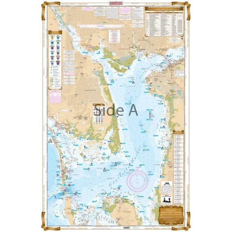

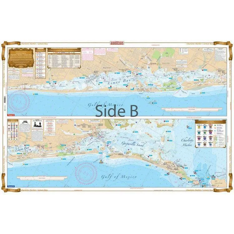
Most details of water proof chart for fishing.
Show all local fishing spot.
Marina, Boat Ramps, Marsh area
Restaurants, GPS Positions
NOAA resource
Easy to read, carry and see the spot right there.
Size: 25" x 38"
| Chart # | Fishing Zone | FL | Location |
| 320F | Lake | SW | Lake Okeechobee |
| 5E | SW | Homosassa to Suwannee River N. | |
| 24E | SW | Boca Grande to Osprey & Lemon Bay |
![Lenco 12" x 18" Edgemount Kit w/Standard Tactile Switch Kit 12V [TT12X18E]](https://www.breezwedge.shop/image/lenco-12quot-x-18quot-edgemount-kit-wstandard-tactile-switch-kit-12v-tt12x18e_UWw8XP_300x.webp "Lenco 12\" x 18\" Edgemount Kit w/Standard Tactile Switch Kit 12V [TT12X18E]")


![Whitecap Pro Dual Feed Motor Flusher w/Rectangular Cups [P-2402]](https://www.breezwedge.shop/image/whitecap-pro-dual-feed-motor-flusher-wrectangular-cups-p-2402_vh0CTE_300x.webp "Whitecap Pro Dual Feed Motor Flusher w/Rectangular Cups [P-2402]")
![Quick Replacement Propeller f/Left Handed BTQ 185-55, BTQ 185-75 BTQ 185-95 Bow Thruster [FVSGEL185L05A00]](https://www.breezwedge.shop/image/quick-replacement-propeller-fleft-handed-btq-185-55-btq-185-75-btq-185-95-bow-thruster-fvsgel185l05a00_WCDOVw_300x.webp "Quick Replacement Propeller f/Left Handed BTQ 185-55, BTQ 185-75 BTQ 185-95 Bow Thruster [FVSGEL185L05A00]")

